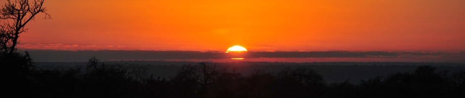

The Eastern Oregon High Desert
Sometimes the best made plans just don’t go as we wish. Our finicky Oregon weather preempted a trip I had mapped out to hike Abert Rim, in South Central Oregon. The plan was to drive down Highway 31, Southeast of La Pine, stop and visit Ft Rock and a few other Fremont National Forest sites including the camp at Summer Lake Hot Springs and then climb Albert Rim early Friday, June 26th.
What really happened is that I spent more time than I had estimated around Ft Rock area and then got some bad weather later in the trip. Now I’m getting a little ahead of myself so let me tell you what I did see that impressed me.
The drive over from Eugene was very pretty, and with all the rain we had recently, Central Oregon was still very green and much in bloom. I made a quick photo stop just outside of Sisters to get a shot of a pasture with horses and the mountains in the background. This is a place that always impresses me and if you stop in the right place you can see all three Sisters, Broken Top, Mt Washington, Three Fingered Jack and Mt Jefferson. Wow!

The Three Sisters near Sisters

Take Our Picture Too!
After leaving Highway 97 just south of La Pine, the pine forest was beautiful and I saw a lot of wildflowers in bloom along the sides of the road. It’s about 30 miles from the Highway 97 junction to where you leave Highway 31 to go into the town of Ft Rock. The town is about 6 miles from Hwy 31 and Ft Rock is only a mile or two from there. Before I got to the town I could see Ft Rock.

Hwy 31 - The Three Sisters

There's Ft Rock!
The best part of the town of Fort Rock was that the local Ft Rock Valley Historical Society had done a wonderful job restoring 8 buildings of what was the town at it’s peak in the early 1900’s. Most of the buildings have been moved from other locations and it does resemble the town that was actually there. A couple more building continue being restored and I was very impressed with how well the were done. The museum/visitor center is worth a look too. An amazing collection of arrowheads, donated largely by one man, line the walls. Few larger museums would have anything have anything as extensive.

Old Ft Rock

Windmill

Look! It still works!

A 1910 Country Kitchen

Inside the School

Hitch Up That Wagon!
Like a desert mirage, the Ft Rock National Natural Landmark rises huge out of the barren, immense flatness of Oregon’s high desert. An enormous near-circle of towering jagged rock walls make it seem like a fort. Hike around and you’ll soon realize it’s even bigger than it looks! It’s an old tuff ring set in what was a large lake some 14,000 years ago, with an estimated surface area of over 900 square miles. As you walk around inside, imagine the early American Indians who canoed to and from what was then an island. A large number of hand woven sage sandals were found in a nearby cave and are the oldest ever discovered in West, dating back around 9,000-13,000 years.

It's Bigger Than I Thought
This place has a real presence and you won’t be there long before you’ll realize that native Americans have used this place for many purposes over the years. I wanted to see the cave where the sandals were found but now it requires a reservation made in the Bend BLM office and only do tours when they get 10 12 persons. I did see it from the distance and the locals call it a “cow cave” as it’s very shallow and the cow often use it for a barn in bad weather.
The formation shape and color all add to the unique sense of place that is found here.

Inside Ft Rock

Inside Perimeter Trail
A few hours later, after and hike around Ft Rock and a visit with the Camp Host that lives in a RV on site for 6 months I realized the day was fast slipping away and if I wanted to see more I’d better be going.
Next on the list was Derrick Cave. It had been over 30 years since I was last there and remembered the skylight lava tube had impressed me. Now, to find it again would be interesting. I had a copy of William Sullivan’s “Eastern Oregon” book with me and it had a description of how to get there. Paved road turned to a good gravel road by the time I got to the Ft Rock Guard Station and past that it was just a dirt farm road. As this area is a mix of private and BLM range land, it’s basically a large farm. There were no more signs but I did run into a couple of farm kids who lived out there and gave me a rough idea of how to get to the parking lot. Without their help, I would have never found it, continuing on the rutted dirt road that forked numerous times. I you ever get a hankering to visit this cave take a good SUV or pickup and if it has rained, take a good 4WD. I knew I was getting close when I passed what Bill Sullivan called a “Splatter Cone”. There was a thin walled cone that looked like it had splattered sticky lava all over the cones and the surrounding area. Finally around 8:00pm I managed to get to what was described as a parking lot. I wandered around for about a half hour and finally found the opening to the cave about a quarter mile from the car. It was too late to explore the cave and there was no way I was going to try to drive out of there in the dark so it looked like a great place to camp. To be sure, no one would be bothering me out there.

Splatter Cones
The next morning I got up early and checked out the cave. There are two holes and the one on the east side has a steel and concrete door frame then only goes about 100 yards before ending. This was a Civil Defense bomb shelter back in the early 1960’s and I wondered who in their right mind would every go to a place like that.

Entrance to Derrick Cave

Bomb Shelter Door
The tunnel to the west is very large and spacious and in the first few yard has a nice skylight. You’ll want a good flashlight and a warm coat as it is cool and wet down there. This tube goes on for about a quarter mile before ending at what looks like a frozen puddle of lava cake batter. There are some 3 – 4 foot stalagmites in places and some smaller stalactites too. The large sky light area is a perfect camping place and you can see people have camped there recently.

Skylight

More Skylights

Flashlight Fun
Early the next morning I wanted to see Crack-In-The-Ground so I consulted the map and saw the most direct route was over Green Mountain. In spite of the drive out from Derrick Cave, this was some beautiful sage and juniper range land and not a bad drive on a gravel road. Currently, there is a manned fire look-out on top of Green mountain. I hadn’t understood the impact of cattle ranging until I looked off the top and could see the huge number of cattle scattered over hundreds of square miles. There certainly won’t be any feed for wildlife for long with as many cattle as they are ranging at this time. There is a small, free, dry camp ground just a quarter mile from the summit and it look like summer-help USFS people were camping there.

Green Mountain Lookout
It was only about 5 mile from there towards Christmas Valley to the Crack-In-The-Ground parking area. A short quarter mile hike over a clearly marked trail leads you to the north end of this volcanic fissure. The eruptions from the Four Craters Lava Field were accompanied by a slight sinking of the older rock surface, forming a shallow, graben-like structure,a depressed block of land bordered by parallel faults, about 2 miles wide and extending to the south into an old lake basin. Crack-in-the-Ground marks the western edge of this small, volcano-tectonic depression. The crack is the result of a tension fracture along a hingeline produced by the draping of Green Mountain lava flows over the edge of the upthrown side of the concealed fault zone. It is located in the southwest corner of Four Craters Lava Field in the Deschutes National Forest. This is a very cool place in sections that are over 70 feet deep! The formations are very striking and it’s not a difficult walk even though you have to squeeze a little in places. The whole crack is over two miles long but the best part is in the first half mile. This one is well worth checking out if you are ever in the area.

Crack-In-The-Ground Enterance

It's Getting Deeper!

Squeeze

A Wide Section

Now Which Way?

Lichens and Fractures
After and hour of so of wandering around the Crack, I took advantage of the still clear morning and shot some pictures of the many wildflowers blooming in this area. Here are just a few I saw on the way back to the car:

Cushion Buckwheat

Modoc Hawksbeard

Mountain Navarretia

Threadleaf Phacelia

Howell's Goldenweed

White Layia
It was noon already so I knew I’d better be on my way. Eight miles away was the town of Christmas Valley consisting of a small community scatter along the main east-west road. Do you remember there is a man-made lake here? Well it wasn’t as impressive as it could have been but I’m sure the locals enjoy it.

The Christmas Valley Lake
Speaking of locals, check out how this local goes to town…

Head'in for Town
On the drive back to Hwy 31 I saw a small band of wild horses drinking in a creek near Sevan Lake, a private reservoir. I’ll bet it’s stocked and good fishing.

Wild Horses

Sevan Lake - A Private Fishing Hole
I got back on Hwy 31 at Silver Lake. If you haven’t been there, it is a dry lake. There is a small town at the west end of the lake by the same name.

Silver Lake
It’s only a short drive from Silver Lake to Summer Lake. Summer Lake was discovered and named by Captain John C. Fremont during his 1843 mapping expedition through central Oregon. Fremont and his Army Topographical team were mapping the Oregon Territory from The Dalles on Columbia River to Sutter’s Fort in Sacramento, California. On 16 December 1843, the expedition struggled down a steep cliff from a snow-covered plateau to reach a large lake in the valley below. Fremont named snow covered rim “Winter Ridge” and the temperate waters “Summer Lake.” Fremont described the discovery and naming of Summer Lake as follows:
“At our feet…more than a thousand feet below…we looked into a green prairie country, in which a beautiful lake, some twenty miles in length, was spread along the foot of the mountain…Shivering on snow three feet deep, and stiffening in a cold north wind, we exclaimed at once that the names of summer lake and winter ridge should be applied to these proximate places of such sudden and violent contrast.” (Captain John C. Fremont, 16 December 1843, Report of the Second Fremont Expedition)

A Fremont Memorial

Old School - Winter Ridge

A Lone Tree At Summer Lake
The Summer Lake Basin supports more than 250 species of birds including bald eagles, Canada geese, white faced ibis, yellow-headed blackbirds, goshawks, hermit thrushes, red-tail hawks, great blue herons, and numerous species of ducks. This makes Summer Lake a favorite bird watching and hunting area.
The Oregon Department of Fish and Wildlife maintains the Summer Lake Wildlife Area on the north side of the lake. The refuge consists of a large wetland marsh fed by the Ana River with associated high desert uplands with an 8.3-mile tour route open to the public most of the year. The refuge headquarters is located adjacent to Oregon Route 31 in the town of Summer Lake.
I loved the contrast of rugged cliffs and formation of Winter Ridge and the flat spacious land of the lake and surrounding area. There are far more bird species than I can identify and I could easily see why birders love the area.

Summer Lake Shore Birds
It had started clouding up as it often does when it’s hot in the desert, and as I came around Summer Lake I could see thunderheads piling up along Winter Ridge. There was some event going on that weekend and Summer Lake Hot Spring was over-run with people. There must have been over 50 folks there and they had a overflow area full that was just plain sage brush and sand. This is a place that, in the past, rarely got 50 visitors a week during the busy season. http://www.summerlakehotsprings.com/ After looking at their web page I see they are really trying to develop a more profitable business.
I decided to drive over to Lake Abert and look at where I’d be trying to climb the rim next day. Alan Butler had advised me to bushwhack up Poison Creek to the rim so I wanted to get a good look at it so I’d know what tomorrow’s hike would be like. By now those big black clouds were closing in on me. For 45 minutes it rained, crashed and boomed as hard as it could. Windshield wipers didn’t have a chance and I was lucky I was at a turnout along side Highway 385 when it hit. One truck came by, weaving all over the road and finally made a turnout a short distance away. Lightning crashed all up an down that Rim and for a while it was kind of like a 30 mile long florescent light trying to start and it was constantly flickering and flashing to a very long thunder drum roll. Wow, what a show! When the first wave had passed I got a few pictures of some of the shore birds, but that didn’t last long.

Abert Rim - Near Valley Falls

Brids On The Shore of Abert Lake

A Snag at Abert Rim
I did see some wildflowers I hadn’t seen anywhere else.

Crytantha

Spiny Hopsage
Now camping wasn’t sounding like so much fun so I decided to drive south toward Lakeview and see if it was any better. I wanted to check out Chandler State wayside, which is a campground a few miles south of Valley Falls. I did stop off and get a picture of the Valley Falls.

The Falls near Valley Falls
The showers continued and I finally decided to go into Lakeview and get a dry room for the night. I got up at the crack of dawn and looked south over Goose Lake and I could still see small thunderheads hugging the mountains. Well, so much for climbing Albert Rim, it’s time to change the plan. There was not way I was going to chance getting caught in a storm like the one on Friday that even made the locals pretty excited. After consulting my maps, I decided to go east to Hart Mountain National Antelope Refuge and maybe even as far as the Steens.

Falls on Warner River
I drove east from Lakeview toward the big city of Adel. This is a beautiful drive as you go through Warner Canyon. I saw a roaring waterfall just off the road and I don’t have the slightest idea of what it’s called. The Warner Valley is just beautiful this time of year and filled with a lot of large farms. I stopped at Adel but the old store wasn’t open.

Adel Store
From there I drove North towards Plush. The drive along the series of lakes (Pelican Lake, Crump Lake and Hart Lake) is very scenic. I saw a lot of wild life including a golden eagle and antelope. Near Crump Lake there was steam rising from some small ponds near the road. They were on private property and there wasn’t any developed pool. I stuck a finger in one small pool right near the road and it wasn’t boiling but it must have been 150 degrees.

Warner Valley - Crump Lake

Undeveloped Hot Springs near Crump Lake

Look! There are some Antelope!

A Speckled Hawk

Warner Rim
Plush is really the big city in this part of the world and according to the sign above the general store, it is a quiet small drinking town with a cattle problem. I guess that says it all . I know it’s a long ways to Lakeview or Burns and those aren’t exactly large towns either.

Plush General Store

Let's see that sign again....

They Know How To Put Them On Ice Here!
From there I drove toward Hart Mountain Antelope Refuge headquarters. The road skirts the lake and the mountains for about 15 miles or more before winding up to the rim. Wow, is this ever beautiful! The desert was in bloom and I hadn’t gone even a mile once I got up on top before I saw my first antelope.

Wild Life Refuge

There's Another Antelope

Hart Mtn Headquarters - The Ranger's House

Hart Mountain
I stopped at the headquarters hoping to pick up a map but there was no one around even though the visitor area is always open. I settled for a drink of cold water then drove up towards the hot springs. The hot springs is in a valley and the creek has patches of aspen. There is a campground there but no drinking water that I could see.

Hart Mtn. - Campground and Hot Springs

Hart Mountain Campground
There are two springs. One is a deep pool with a ladder inside a 6 foot rock wall. A sign said “20 minute limit if others are waiting”. Fifty yards away in an open field is a natural spring. This one is a little warmer at about 104 degrees and offers an incredible view of Hart Mountain and the surrounding valley. There is still patches of snow in some of the shadier places up the valley.

Hart Mtn Hot Springs - Developed Pool

Hart Mtn. Hot Springs - Natural Pool
After a good soak in both pools and a bite of lunch, I decided to go back out on the plateau and shoot wildflowers. I would have camped there for the night but I could see those big black clouds loom up in the south. It seemed everywhere I looked I saw antelope! While taking some macro shots of flowers, I looked up only to find a very curious antelope watching me 20 yards away. It was very clear he just couldn’t figure out what I was doing. I’ve been out here on several occasions but I’ve never seen as many antelope as I did that day. Even the rangers remarked about how many they had seen.

Pronghorn Antelope

A Young Buck

Hart Mtn. - The Desert In Bloom
Here is a little closer look at a few of the many wild flowers that were in bloom:

Tansey-Leaved Evening Primrose

Foothill Daisy

Desert Yellow Daisy

Meadow Larkspur

Round-headed Desert Buckwheat

Tapertip Onion

Thick-leaf Thelypody

Another Antelope?
I drove east in the direction of Frenchglen. I thought maybe I could spend a little time in the Steens. The Hart plateau streaches for 40 or 50 miles and was just beautiful. The wide open space, being able to see 50 miles in any direction really gives a fellow enough elbow room to breath. I can see why a person would get rather claustrophobic coming back to western Oregon with all those trees and hills that get in the way. I stopped at Rock Creek Reservoir and shot some picture of a flock of pelicans. The shore was covered with yellow flowers and the whole place was unbelievably beautiful.

Rock Creek Reservoir and the Steens Mountains

White Pelicans at Rock Creek Reservoir
It was 70 mile for the Hart Mountain headquarters to Frenchglen. This was some flat, wide -open country and the gravel road could go for miles without a curve. I did see one other car in the 70 miles and the driver looked surprised to see me. As you near the foothills to the Steens,the valley is called the Catlow Valley and streaches north-south for at least 50 miles.

Malheur Refuge and the Steens from just above Frenchglen
It was 2:00 and I hadn’t eaten much so I decided to stop at the hotel and have lunch. This is a very nice historic hotel with a small park on the east side of the building. The food was very good. The special was a big juicy BLT on a large round of sour dough and a bowl of delicious home made soup. But that was really nothing compared to the big hunk of Marion berry cobbler with a rather large scoop of vanilla ice cream to go with it. I learned from the proprietor that the road up to East Rim was closed at Fish Lake and there was still snow there. Well, so much for the visit to the Steens. It would have to wait until another time.

The Frenchglen Hotel

The Frenchglen City Park

Frenchglen Mercantile
I revised my plan again and decided to see as much of the Malhuer Refuge as I could. The clouds were still coming from out of the south so I decided to go for a dry room in Burns and not take my chances of getting soaked.
The road north follows the wetland and a substantial canal for 20 miles. I stopped several place to watch birds and look for other wildlife. There is quite a variety of birds and many were species I wasn’t familiar with.

White Egret

Look at those red legs!

White Pelicans

Looking for dinner in a march.
While walking a dirt road near a pond I ran into a Killdeer. Killdeer nest on the gound and are quite protective of their nest. If you get too close to a nest, the Killdeer will come up to you and put on a ” hurt bird” act to draw you away.

Killdeer

The Hurt Bird Act
Oh, look at that cowboy!

Home On The Range
Yeah, I know that doesn’t look quite right but some farmer has a good imagination and has given all the photographers some fun.
Here was one of several overlooks to give you a feel for the vastness of the refuge.

Malheur Refuge - Buena Vista Overlook
I got so absorb in photographing birds I didn’t reach the headquarters until a little after 4:00pm only to discover that they close at 4:00. This is a very nice place and well worth spending some time when they are open. I browsed through a museum building and saw a huge collection of mounted birds. There are several hundred species that migrate through here at different times of the year and they have a great list of earliest arrival time for the different species going both north and south.

Malheur Refuge Headquarters
It was after 7:00 by the time I got to Burns and I was ready for a good meal and a soft bed. It had been 4 days and 3 night and that felt like a pretty short trip even though it wasn’t what I had planned. June is a wonderful time to see eastern Oregon and maybe this will motivate you to go see some of Oregon’s rugged beauty and maybe take a walk on the wild side too some day.
Enjoy!
Dennis

The Road Back Home
